
Casa Grande ZIP Directory Coverage
USPS groups four current numbers under Casa Grande. Census ZIP Code Tabulation Areas add two more zones that partly overlap the municipality. This distinction controls the coverage table: the first four are Casa Grande delivery identities, while the last two are neighboring census approximations that touch city land. A postal label alone cannot settle whether an address lies inside Casa Grande.
| ZIP | Areas Covered | Post Office | Notes |
|---|---|---|---|
| 85122 | Principal central, north, and east urban Casa Grande | 1670 N Pinal Avenue, 85122-9998 | Established delivery zone; not coterminous with the city |
| 85130 | USPS grouping under Casa Grande | No separate staffed station verified | Likely special or nonstandard; verify each address |
| 85193 | Rural southwest and west Casa Grande postal territory | Parent destination 85122 | Extends outside city limits |
| 85194 | East, northeast, and I-10 edge | Parent destination 85122 | Extends outside city limits |
| 85131 | Eloy ZCTA with a portion overlapping Casa Grande | Eloy postal community | Census overlap, not a Casa Grande USPS grouping |
| 85172 | Stanfield ZCTA with a portion overlapping Casa Grande | Stanfield postal community | Census overlap, not a Casa Grande USPS grouping |
The Casa Grande postal directory therefore uses two layers. Delivery research centers on 85122, 85130, 85193, and 85194. Boundary research also checks 85131 and 85172 because Census geography reports portions within municipal Casa Grande.
Casa Grande ZIP Postal Terms
Postal vocabulary can make the same address look like several different places. A ZIP is a mail-routing unit. A ZCTA is the Census Bureau’s statistical approximation of one. Neither is a city boundary, voting district, school district, or parcel line. Casa Grande records should preserve the postal form found in the source, then add a verified modern form without erasing the old one.
- ZIP versus ZIP+4
- The five-digit area routes a broad set of deliveries; the extra four digits narrow mail to a smaller segment or destination.
- PO-box ZIP
- A number assigned chiefly to post-office-box delivery rather than a normal street territory.
- Unique ZIP
- A number reserved for one high-volume organization or destination. No Casa Grande example was verified in the research.
- Carrier route
- The smaller delivery path followed by a postal carrier within a five-digit zone.
Those terms describe mail. The parcel roll supplies situs, which means physical property location, while the legal description identifies land by lot, block, subdivision, or metes and bounds.
Casa Grande’s 2007 ZIP Split
Historical address research must account for a well-documented local change. The 2007 USPS Postal Bulletin notice created 85293 from 1,822 deliveries that had used 85222 and created 85294 from 3,373 former 85222 deliveries. A later regional prefix conversion changed those forms to 85193 and 85194. The street or parcel may not have moved even though the number printed in a deed, directory, newspaper, or tax notice changed.
Search 85222, 85293, and 85294 alongside the modern 851 forms. Keep the parcel number and legal description as continuity keys. A failed modern postal search may reflect an old alias rather than a different property or person. This quirk is especially useful when a Casa Grande record was created near the change.
Historic alias. Record both the old and current postal forms, but never rewrite the source as if it used the modern number.
Verify Casa Grande ZIP Delivery
The USPS ZIP Code Lookup is the authority for the postal form assigned to a complete address. It can confirm whether a street is routed under Casa Grande, Eloy, Stanfield, or another postal community. Enter the full address before using the number as a filter elsewhere. A city-name-only search is too broad for the rural and peripheral delivery areas around Casa Grande.
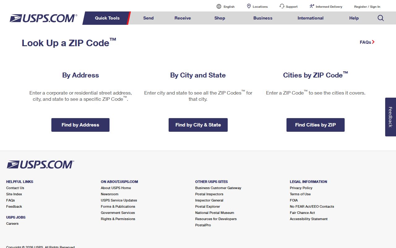
The result answers a mail-routing question. It does not prove municipal jurisdiction. After USPS verification, locate the parcel in Pinal County GIS or the Assessor search and compare the city boundary separately. That two-part check prevents a Casa Grande mailing name from being treated as a legal city finding.
Find Casa Grande Residents by ZIP
There is no single open roll that lists every Casa Grande resident in one postal zone. Official sources instead expose owners, tax-mail recipients, recorded parties, and limited voter information. The workflow below starts broad with postal geography, then moves to record types that state exactly what they contain.
- Confirm the current postal form for the full address through USPS. Save any older 852-series form found in the source.
- Use the Pinal Treasurer form to search tax-mail city and postal fields. Treat those results as correspondence destinations, not an occupant list.
- Open the parcel in the Assessor search and GIS viewer to verify property location, owner, parcel number, legal description, and city-boundary context.
- Use a voter tool only for authenticated self-service or a purpose allowed by A.R.S. §16-168. It is not a public postal-zone browser.
- Once the zone narrows the area, move to the Casa Grande street directory for parcel-level and by-address research.
Each result should retain its label. Owner, tax-mail recipient, registered voter, and occupant are not interchangeable identities.
Filter Casa Grande ZIP Tax Mail
The Pinal County Treasurer Parcel Inquiry is the verified county portal with a ZIP or Postal Code field. It accepts partial data and updates nightly. Results list parcel number, owner name, city, state or province, and postal number, with page-size controls and CSV export. The address fields belong to the tax-mail context, which may differ from the physical Casa Grande parcel.
| Field Label | Type | Required | Format or Use |
|---|---|---|---|
| Owner Name | Text | No | Last name first or business name; partial entries accepted |
| Tax Year | Year | No | Use a named year when historical tax activity matters |
| Address | Text | No | Owner mailing context, not necessarily situs |
| City | Text | No | Mailing city |
| ZIP/Postal Code | Text | No | Mailing filter |
| State/Province and Country | Text | No | Further narrows the mailing destination |
The Treasurer search screen shows why postal filtering belongs to the mail side of the record.
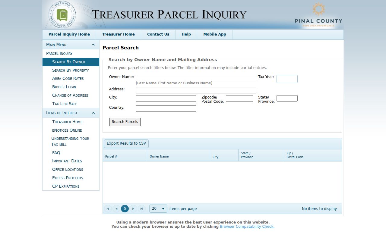
Use the parcel-specific tax history, bills, coupons, and receipts to date tax activity. Then return to the Assessor and Recorder for physical location and title. A recent payment or transfer may lag until the nightly update.
Confirm Casa Grande ZIP Parcels
The Pinal County Parcel Search does not present a postal-zone filter in its captured field set. It searches owner name, split street components, parcel-number components, subdivision, section-township-range, and cabinet-slide-lot. That makes it the right second step after one address has been identified. Capture both PROPERTY ADDRESS (LOCATION) and TAX BILL MAILING ADDRESS, plus the parcel number and legal description.
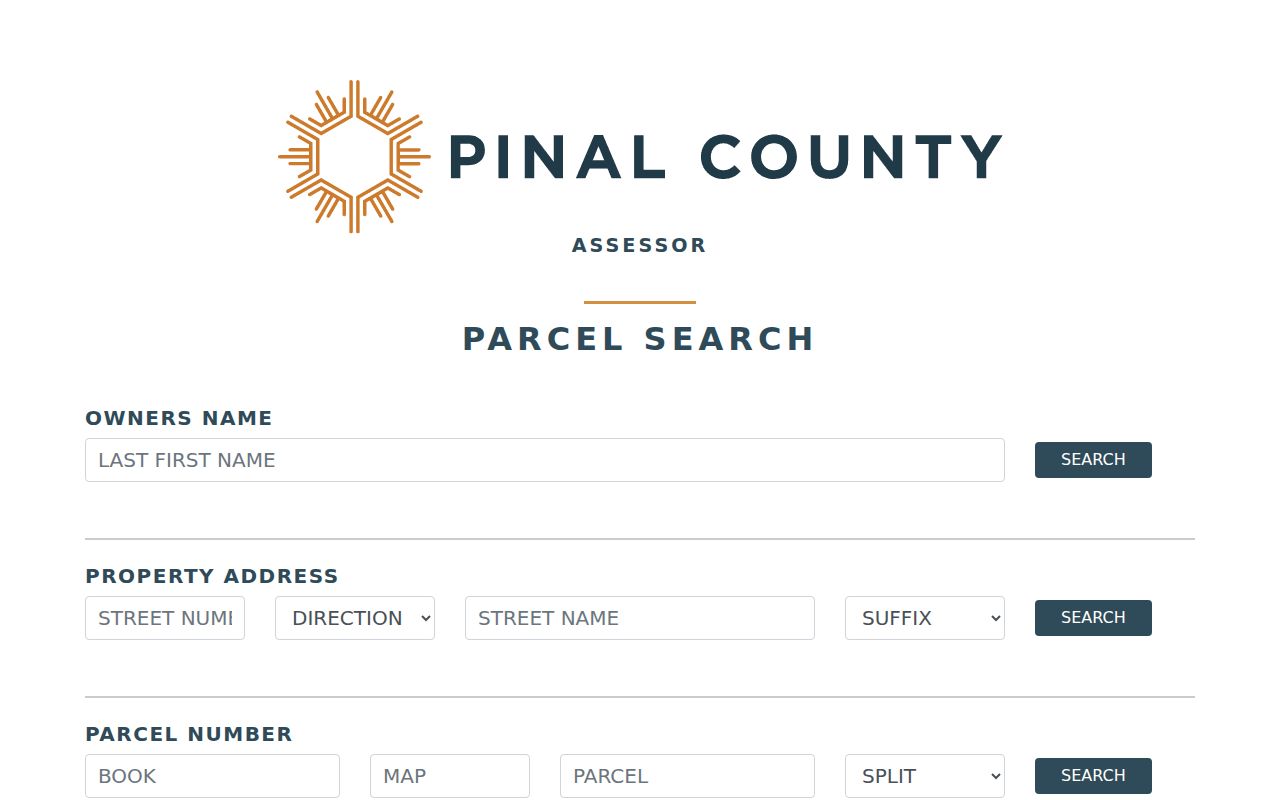
The two address fields explain many false matches. The mailing destination can lead to an owner in another zone or state; the property address locates the land. A legal class may suggest primary, nonprimary, or leased treatment, but it does not name every person at the Casa Grande address. For help, the Assessor branch at 820 E Cottonwood Lane is open Monday through Thursday from 8:30 a.m. to 3:30 p.m., and the office answers 520-866-6361.
Casa Grande ZIPs Versus Limits
Delivery zones, ZCTAs, and legal city limits overlap without matching. 85193 reaches rural southwest and west territory outside Casa Grande. 85194 extends along the east, northeast, and I-10 edge beyond the municipality. In the other direction, Census reports portions of the Eloy 85131 and Stanfield 85172 ZCTAs within municipal Casa Grande. The Census QuickFacts profile describes the legal city population, not a postal-directory total. The correct office for a record depends on the event and jurisdiction, not just the city printed in the mailing line.
The Pinal County parcel viewer supplies parcel geometry and district context. Other county viewers cover planning, flood, justice precinct, school district, voter district, and zoning layers. If exact city jurisdiction matters, compare the parcel to the relevant boundary rather than drawing a conclusion from postal routing. Written requests should name the parcel number, address, record type, and office instead of asking for every resident in a broad zone.
Note: USPS routing and Census statistical geography answer different questions, so a mismatch is normal rather than an error.
Preserve Casa Grande Address Identities
A complete Casa Grande record trail may carry four address identities. Situs is the physical parcel. Mailing is the destination for tax correspondence. Legal is the lot, block, subdivision, or land description used to keep title continuous. Postal city and number route mail. City limit answers a fifth question: whether municipal jurisdiction applies. Keeping those facts in separate notes prevents one field from being asked to prove too much.
Casa Grande began as the railroad stop Terminus in 1879, was renamed in 1880, and had a townsite laid out along the railroad in 1892. Farm, rail, historic-core, postwar, and peripheral addresses entered record systems at different times. Early residents may appear under a rural route, post-office box, farm description, old prefix, or neighboring postal city. The stable parcel number and legal land description often bridge those shifts better than street text.
The Casa Grande postal directory is most useful as a geographic first pass. USPS confirms delivery. The Treasurer supplies tax-mail filtering. The Assessor and GIS establish the parcel. Deeds, directories, voter records, and other sources then answer their own limited questions without turning a postal label into proof of residence.